Borderline Game — Tap the Country on the Map
A free daily geography map quiz: tap where each country is on a blank world map and see how many kilometres off you were. Nothing to draw.
What is the Borderline game?
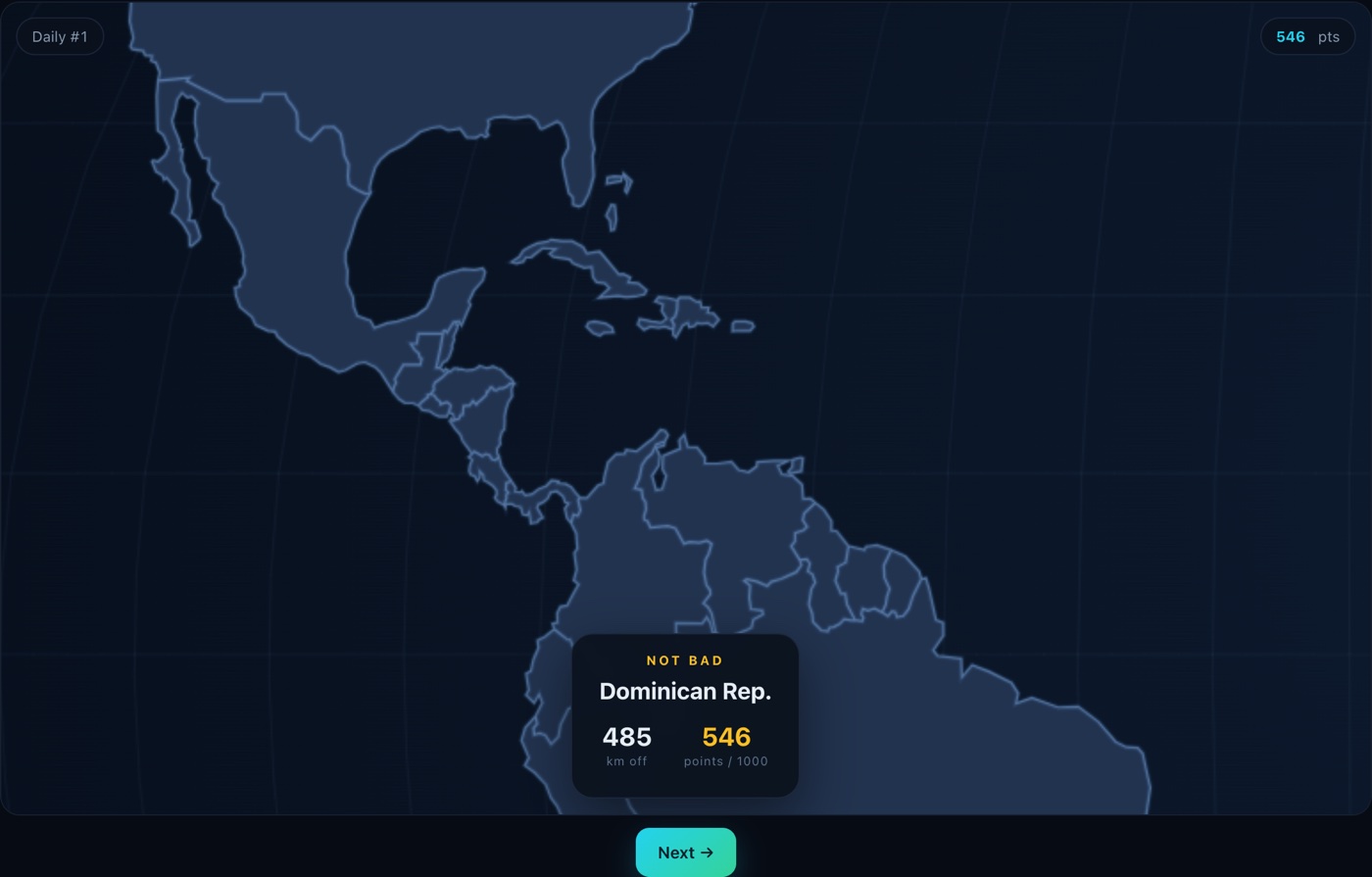
The Borderline game is a free browser geography game about knowing where countries are. A country name appears, the map has no labels, and you tap the place you think it sits. The game measures the distance from your tap to the nearest point of that country's real border, tells you the gap in kilometres, and turns it into a score out of 1000.
There are two ways to play: a daily challenge of five countries that is the same for everyone playing that day, and a practice mode that deals five random countries whenever you want. No account, no install, no ads, no cross-site tracking. Your streak and best scores stay in your browser; finishing a daily sends only the date, your score and an anonymous device ID, so the page can tell you what share of today's players you beat.
The map behind the Borderline game is Natural Earth 1:110m data, covering 176 countries. Nothing is labelled — no country names, no capitals, no highlighted borders. That is the whole game: recall, not recognition.
Most daily geography games hand you a clock, a globe or four options to pick from; the Borderline game hands you an unlabelled map and one tap.
What this Borderline game measures
Knowing that Mali is in West Africa is the easy half. The other half — where in West Africa — is the part that shows up the moment you look at a blank map, and almost nobody has ever had it tested.
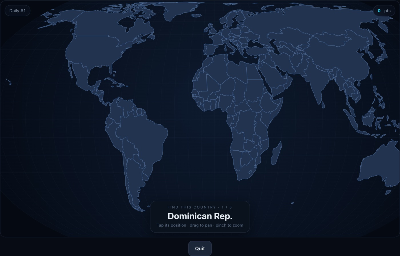
That is what the tap mechanic is for. Instead of stopping at "roughly the right region", every answer is a number: 60 km is a careless slip, 600 km usually means the right neighbourhood and the wrong spot, 2,000 km means the mental map has a hole in it. Three different mistakes, three different fixes.
The score keeps that gradient, which is what makes a second and third attempt worth anything. You are not collecting points, you are narrowing an error term.
How to play the Borderline game
- Read the country name at the bottom of the map.
- Find it. Drag to pan, scroll or pinch to zoom — no country is labelled.
- Tap its position. Anywhere inside counts as a direct hit.
- Read the distance. The map zooms to the answer and shows your gap in km.
- Repeat five times. Your five scores add up to a maximum of 5000.
The full rules cover the two modes, the scoring curve band by band, the country list and the controls on a phone.
How the Borderline game scores you
Each round is scored out of 1000 using the great-circle distance between your tap and the nearest point of the country's real boundary:
score = 1000 × e−km / 800
That curve is deliberately not linear. A linear scale would punish near-misses far too hard: tap 50 km from the border of France and you would lose a fifth of the round, even though you clearly know where France is. The exponential decay keeps the top of the range generous and compresses the difference between "wrong region" and "wrong continent".
| Distance from the border | Score | What it means |
|---|---|---|
| 0 km (inside the country) | 1000 | Direct hit |
| 100 km | 882 | Right region, coarse placement |
| 500 km | 535 | Neighbouring country |
| 1000 km | 287 | Right continent, wrong part of it |
| 2000 km | 82 | Off by a whole region |
| 3000 km+ | < 25 | Wrong continent |
The Borderline game measures distance to the boundary, not to a country's centre point. That matters more than it sounds: for large or oddly shaped countries a single centre point is misleading — the geometric centre of France sits in the Bay of Biscay, and the centre of Norway sits in the Norwegian Sea. Measuring to the boundary means tapping anywhere legitimately inside a country always scores a direct hit.
That also makes it a border game in the literal sense: every point you score is a function of how far you are from a border, which is why the reveal shows the country outline rather than dropping a pin.
The hardest countries to find
Difficulty in the Borderline game is computed from geometry alone, never from anyone's opinion: how much of the map a country occupies at world zoom, combined with how close its nearest neighbour sits. Small countries packed into a crowded neighbourhood are the hardest, because a tap that is a few pixels off lands in a different country.
| # | Country | Size (world zoom) | Nearest neighbour |
|---|---|---|---|
| 1 | Cyprus | 2.4 px | 62 km |
| 2 | Luxembourg | 1.5 px | 139 km |
| 3 | Israel | 4.7 px | 73 km |
| 4 | Brunei | 3.2 px | 130 km |
| 5 | Montenegro | 3.6 px | 134 km |
| 6 | Gambia | 3.7 px | 140 km |
| 7 | Macedonia | 4.9 px | 127 km |
| 8 | Lebanon | 3.1 px | 226 km |
| 9 | Slovenia | 4.3 px | 165 km |
| 10 | Rwanda | 4.7 px | 152 km |
| 11 | Belgium | 5.3 px | 139 km |
| 12 | Burundi | 5.0 px | 152 km |
Size is the equivalent pixel side length of the country's true surface area on a 1000 px-wide world map. Neighbour distance is measured between country centres (great-circle). This is a geometric ranking, not a record of player results.
At the other end, the easiest are the ones nobody gets wrong: Russia, Canada, Australia, the United States, Brazil and China each occupy more than 85 pixels of side length at world zoom, with no ambiguous neighbourhood to fall into.
How to get better at finding countries
Anchor to latitude
Most people place countries correctly in longitude and badly in latitude. The 49th parallel is the US–Canada border for 2,000 km; the equator runs through Kenya, Indonesia and Brazil. Knowing roughly what latitude a place sits on eliminates most north–south errors.
Learn coastlines before interiors
Coastal countries have a free anchor: the sea. Chile, Norway, Portugal and Vietnam are all "somewhere on an edge" — once you know which ocean and roughly which stretch, the rest follows. Landlocked countries in dense regions (the Balkans, Central America, West Africa) are the ones worth deliberate memorisation.
Use neighbours as a chain
Countries are easier to recall as adjacency chains than as isolated points. "Chile is west of Argentina, which is south of Bolivia, which is west of Brazil" is a route you can walk in your head. Isolated single facts decay; linked facts reinforce each other.
The daily, practice mode and your streak
The daily is five countries derived from the UTC date, so it is identical for every player and changes at midnight UTC. One attempt per day, 1000 points per country, 5000 for a clean run. That constraint is the point: a score only means something if everyone answered the same five countries with the same information.
Practice deals five random countries from all 176, as many times as you like, and leaves your streak alone. It is where you go to fix a specific gap rather than to find out where you stand.
Your streak counts consecutive days on which you finished a daily. It lives in local storage
alongside your best total — there is no account and no profile on our side, so clearing site
data resets it. A completed daily also posts the date, your total and an anonymous device ID to
our own score endpoint, which is what turns "I got 3,800" into "I beat 62% of today's players";
nothing else about you is sent. "Copy result" puts a plain-text summary —
Borderline #n, the date and your five round scores — on your clipboard if you want
to paste it somewhere.
Frequently asked questions
What is the Borderline game?
The Borderline game is a free browser geography game about knowing where countries are. You get a country name and an unlabelled world map, you tap the place you think it is, and the game tells you how many kilometres off you were and turns that into a score out of 1000. Five countries a day, or unlimited practice.
Is Borderline a drawing game?
No — you tap, you never draw. Several browser games share the name Borderline and some of them ask you to trace a border from memory; this one deliberately does not. Scoring a drawing means intersecting two polygons and turning that overlap into a number, which folds mouse control into the score. Scoring a tap means one great-circle distance, which does not. If you came here to draw, this is the wrong page — and that is a design decision, not an oversight.
Why is it called Borderline?
Every round is decided by a border: your score is the distance from your tap to the nearest line on the map. The interesting answers are the borderline ones too — not right, not wrong, just a measurable distance off. It is one word here, but plenty of people find it as “border line game”.
Is Borderline the game free? Do I need an account?
It is free and needs no account. Your streak and best total are stored in your browser's local storage. When you finish a daily, one small record leaves the device so you can see what share of today's players you beat: the date, your score, and a random ID made on your own device. No name, no email, no login and no cross-site tracking.
How is the score calculated?
Each round is scored out of 1000 with score = 1000 × e^(−km / 800), where km is the great-circle distance from your tap to the nearest point of the country's real border. Inside the country is a direct hit, 1000 points. 500 km away scores 535. 2000 km away scores 82.
How does the daily geography puzzle work?
Five countries are chosen from the date itself, so everyone playing on the same UTC day gets the same five. It resets at 00:00 UTC, and a clean run is 5000 points.
Why can't I tap tiny countries like Monaco?
The map uses Natural Earth 1:110m data, which does not include the smallest states — Monaco, San Marino, Liechtenstein, Andorra, Vatican City, Singapore, Bahrain and Malta are not in the dataset. This is deliberate: at world zoom they occupy less than a pixel, so any tap would be a guess rather than a memory test.
Where does the map data come from?
The Borderline game takes all its boundaries from Natural Earth (1:110m scale), which is in the public domain. There are no third-party map tiles and no API keys — the whole map is rendered from a single data file the browser downloads once.
Does it work on a phone?
Yes. Drag to pan, pinch to zoom, tap to answer. In portrait the map fills the height of the screen and you pan left and right, because a world map is about twice as wide as it is tall.
Keep going
The Borderline game is built to be a two-minute habit rather than a session: one daily run, five countries, then close the tab.